Northern Ireland’s secret underground river
 The Edge Digital Photography/Getty Images
For 170 years, the river that gave Belfast its name has been buried underground in a hidden tunnel. We descended into the city’s cavernous underbelly to find it.
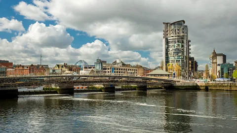
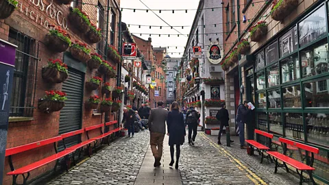
Tens of thousands of people pass by downtown Belfast’s Victorian turrets, buzzing quaysides and cobbled Cathedral Quarter streets every day – but few people realise that there’s a secret hiding just below their feet.
Buried just 60cm beneath the city’s modern surface, the long-lost River Farset that gave Belfast its name still flows silently through the heart of Northern Ireland’s capital. In fact, Belfast, or Béal Feirste (‘the sandy ford at the mouth of the Farset’, in Irish) not only owes its existence to this river, but also its growth and early prosperity. Yet, for the last 170 years, this ancient waterway has been sealed off from the outside world by a series of tunnels, and is largely forgotten by those walking just above it.
“If you stopped anyone in downtown Belfast to ask, they wouldn’t have a clue that there’s a river running through the centre of High Street where boats once sailed up and down,” said Des O’Reilly, author of the book Rivers of Belfast: A History and a professor of early Irish history for more than 40 years. “But the Farset is how everything started, and if you look closely at Belfast today, you can see how it’s always shaped the town.”
 Eliot Stein
According to O’Reilly, Belfast was founded at a natural crossing point where the little-known Farset flowed into Belfast’s centrepiece, the River Lagan. This formed a narrow sandbar at what is now the corner of High Street and Victoria Street. Today, this is the site of the iconic St George’s Church, but the modern building stands on an ancient chapel, where, more than 800 years ago, pilgrims waiting to ford the mud flats at low tide would pray for a safe river crossing.
You may also be interested in:
• Ireland’s secret to a low-key life
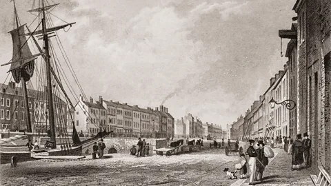
Protestant settlers from Scotland and England began arriving in the 1600s, and the banks of the Farset soon developed into the first quaysides of the burgeoning merchant town, with docks, piers and ships rather than shops lining what is now High Street. In the late 1700s, it was one of several Belfast rivers – along with the Blackstaff – that provided power for the textile mills, distilleries and factories that fuelled the Industrial Revolution. By the end of the 1800s, the Farset had helped propel Belfast into the world’s leading linen manufacturer, and some 50,000 people worked in the mills along its banks in west Belfast.
“Back then you probably would have smelled Belfast before you saw it,” said Ruairí Ó Baoill, author of Hidden History Below our Feet: The Archaeological Story of Belfast. “The Farset is symbolic of Belfast and industrialisation. It’s the secret river you can’t see anymore, but that’s because it was an open sewer.”
Families and factories found it a convenient place to dump rubbish, and by the early 1800s, the wafting smell had become so bad that the town’s commissioners were forced to do something. One million bricks and 40 years later, the last section of the Farset that flowed through the city centre was buried underground in 1848, and it has remained hidden from sight ever since.
 De Luan/Alamy
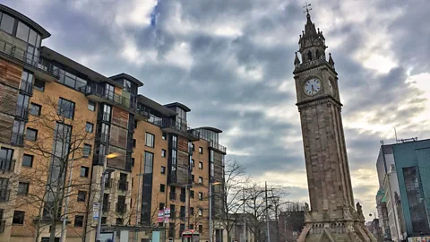
These days the invisible river runs parallel to the ‘Peace Lines’ that long separated Protestants and Catholics, threads Castle Street and Bank Street and winds directly under High Street, giving the road its distinctive curve and width. It then flows to the left of the towering Albert Memorial Clock and empties into the Lagan at Donegall Quay.
“Just because you can’t see it doesn’t mean it’s not there,” Ó Baoill said, pointing to a small opening directly below the popular Big Fish sculpture where the Farset still disgorges into the Lagan.
An urban archaeologist, Ó Baoill has made it his mission to help spread awareness of the little river’s major role in Irish history, and he’s not alone. In the last few years, there have been a number of ambitious efforts to reopen stretches of the long-neglected river and transform it into a greenway. More recently, Belfast’s City Council organised a citywide Farset Project to celebrate the invisible river.
As I followed Ó Baoill from the quay into the heart of Belfast, it became apparent just how much the underground river’s influence still echoes above the city’s surface.
“This is the ‘Leaning Tower of Belfast’,” Ó Baoill said, pointing up to the sandstone Albert Memorial Clock, one of the city’s most recognised landmarks, which soars at a 1.25m slant. “We’re walking directly on top of the Farset on muddy, reclaimed land, which causes heavy buildings to tilt.”
 Eliot Stein
Arriving at the corner of Victoria and High Streets, where the Farset once emptied into the Lagan, Ó Baoill explained that there was once a quay here where larger ships would have unloaded things like wine, spices and tobacco so that smaller barges called ‘lighters’ could transport them up and down High Street.
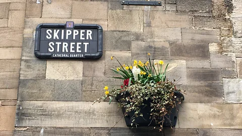
“This whole area would have been filled with sailors importing and exporting goods on the banks – where High Street’s pavements now are,” Ó Baoill said as we passed Skipper Street, where captains once lived. “Over time, warehouses, inns and pubs sprouted up along the Farset to look after these sailors and travellers.”
One block away, Bridge Street gets its name from a small footbridge that once crossed the Farset to reach The Entries, a series of narrow alleyways off High Street where merchants lived.
“These alleys served as jetties for seamen sailing up and down the Farset, and so a lot of the old pubs off High Street still have nautical names, like the Mermaid Inn,” said Jinny Joiner, a waitress at the 208-year-old The Morning Star bar and restaurant. “But now the river’s long gone.”
 Eliot Stein
Or so it seems. According to Frankie Mallon, an engineer with the Department for Infrastructure (DfI) Rivers, in the 170 years since the Farset was sealed off, only two members of the public have been allowed to venture underground to see it. I’d be the third, provided I take some precautions and meet Mallon at a nondescript manhole cover where Belfast’s bustling Castle Junction hits High Street at exactly 17:21.
“It’s a dangerous area,” Mallon said, passing me a jumpsuit, hard hat and Wellington boots, and strapping a 10kg oxygen tank around my shoulders. “Hazardous gases, possibly sewer breach, corrosive liquids. There’s a reason we don’t take people down.”
As a crowd of curious bystanders looked on, members of the Rivers Agency unearthed a heavy metal grate from the pavement and slid a ladder into Belfast’s cavernous underbelly. After a quick glance at his watch, Mallon told me we needed to move now to hit low tide, so I clenched my notepad between my teeth and slowly descended into the dark, damp domain.
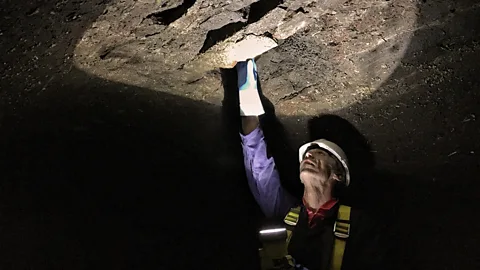
“The smell’s long gone,” Mallon said, shining his torch through a circular, 2m-wide pitch-black abyss winding underneath High Street. “But in the 18th Century, this was an absolute cesspit.”
 Eliot Stein
At low tide, the Farset was much more trickle than torrent, with cold, fresh water flowing through the culvert towards the Lagan 500m away. At high tide, Mallon said some 63,000 litres of water from the Lagan would be gushing back through the conduit, reaching the top of the tunnel, a mere 0.6m below High Street.
As we slowly sloshed through the subterranean passage, the world above was eerily silent. Mallon explained that the Victorian-style, tapered-brick vault is reinforced by two walls built 0.5m thick and topped with wedged timber that’s holding the modern city above it. “It was a complicated process in the 1800s, and it’s still in amazingly good condition – except for one part,” Mallon said, motioning up at a crack where water was rushing in from a broken pipe overhead.
After trudging some 200m underground, we turned and headed back towards the ladder and the light above. Mallon rubbed his gloves over the bricks, dyed black by centuries of industrial runoff, and explained that this water is what brought his ancestors to Belfast.
“Like so many others, my whole family came from various places in Ireland to work in the linen and cotton industries powered by the Farset,” he said, aiming his torch over the water’s dark depths. “This river has some stories to tell, but these days, we’re the only ones lucky enough to see it.”
Join more than three million BBC Travel fans by liking us on Facebook, or follow us on Twitter and Instagram.
If you liked this story, sign up for the weekly bbc.com features newsletter called "If You Only Read 6 Things This Week". A handpicked selection of stories from BBC Future, Earth, Culture, Capital and Travel, delivered to your inbox every Friday.
