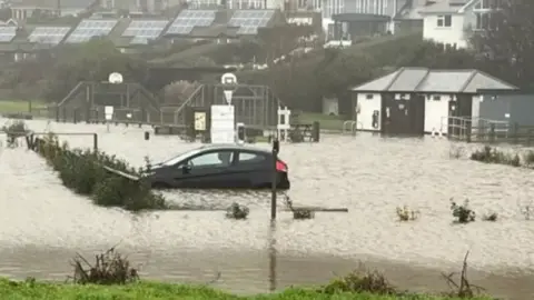
Devon flood risk warnings from the Environment Agency
 Keith Smith
The Environment Agency (EA) has issued updated flood warnings for the areas around five main rivers in Devon.
The River Avon, Clyst, Lew, Taw and Torridge are being closely monitored due to to heavy rainfall, the EA said.
It strongly urged residents to take action as "flooding continues to be expected on Sunday evening and into Monday".
In updates, it showed six locations had already surpassed the limits for possible property flooding.
River Avon
At about 17:00 GMT the EA reported the River Avon level at Didworthy was at 1.26m (4ft).
It said: "Property flooding is possible when it goes above 1.5m (4.9ft).
"Properties and low lying areas in South Brent, Avonwick, Brushford and Manor House near DiptfordGara Bridge, Loddiswell and Aveton Gifford will continue to be at risk on Sunday evening into Monday."
River Clyst
At about 17:00 GMT the EA reported the River Clyst level at Ashclyst was 2.29m (7.5ft), with property flooding possible above 2.5m (8.2ft).
It said the level at Clyst Honiton was 2.4m (7.8ft), the height at which flooding can occur.
It also added that the level at Withy Bridge had surpassed the property flooding threshold of 1.8m (5.9ft) to 1.81m (5.93ft).
The EA said: "Properties and low lying areas around Ashclyst Farm, Burrow Bridge, there is likely to be deep road flooding in the Burrow area, Broadclyst Bridge, Clyston Mill, Dymond's Farm, Sowton Barton and properties and farms between Clyst St. Mary and Topsham including Newcourt Barton and Cotts Farm."
River Lew
At about 17:15 GMT the EA said the River Lew level at Gribbleford Bridge was 0.93m (3ft), with property flooding possible above 2.1m (6.8ft).
It added the level of the River North Lew at Norley Bridge was 0.69m (2.2ft), about 1m (3.2ft) lower than the flood level.
The EA added: "If river levels continue to rise, properties around Gribbleford Bridge and at Hatherleigh - including the fire station, petrol station, public house, lower end of Bridge Street and the A3072 and A386 - may be affected."
River Taw
The EA reported at about 16:50 GMT the River Taw level at Newnham Bridge was 3.24m (10.6ft) and the River Yeo level at Lapford was 2.76m (9ft).
It said property flooding was possible in both locations above 3m (9.8ft).
The EA flood warning was put in place for riverside locations and roads between Taw Bridge and Newnham Bridge, including Coldridge, Chenson, Eggesford, Chawleigh, Bridge Reeve, Colleton Mills and the B3220 at Taw Bridge.
River Torridge
The EA said the River Torridge level at Weare Giffard, Dolton and Torrington had surpassed the level of possible flooding by up to 0.6m (1.9ft) in a series of updates issued about 17:00 GMT.
It added: "Properties and low-lying areas in Taddiport (properties around Taddiport Bridge, Sewage Treatment Works and B3227) and Weare Giffard (riverside properties and roads), will remain at risk, from flooding into Sunday evening and overnight."
Follow BBC Devon on X, Facebook and Instagram. Send your story ideas to [email protected].
