Roman road to tunnels: History of town's bypasses

 Shropshire Archives
With plans for Shrewsbury's North West Relief Road paused this week, a long history of new roads around the town could be coming to an end, at least for the time being.
The Liberal Democrat administration elected to run Shropshire Council in May had stood on a platform of cancelling the route, and is in talks with the government to permanently end the project.
Since cars started to become popular nearly 100 years ago, until the last big stretch of bypass was constructed at the end of the last century, Shropshire's engineers and politicians have expanded the road network to deal with growing traffic.
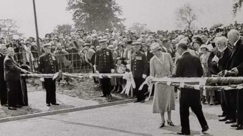
1933: Thieves Lane to Roman Road
When Thomas Telford built what would become the A5 in the early 1800s, it was so central that he demolished part of Shrewsbury Abbey on his way through the town.
Despite the widening of English Bridge in the 1920s, the double river crossing and narrow streets in the town centre became an unsustainable route for growing traffic on the main London-Holyhead Road.
So a plan was hatched to dodge the river loop altogether and build a new road joining Thieves Lane from Emstrey to Roman Road at Shelton.
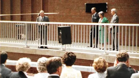
It was opened in May 1933 by the then Princess Royal.
 Ordnance Survey
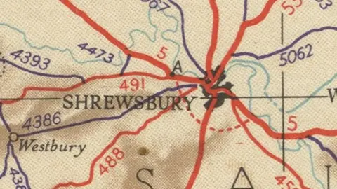
1953: Tunnelling under town?
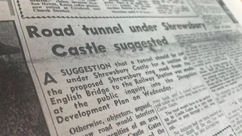
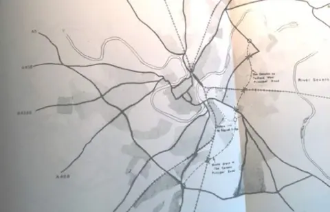
This one never made it, but a 1950s proposal would have seen a bypass inside the river loop, between the English Bridge and the railway station.
Part of this would have run along the river, but the Shrewsbury Chronicle of 11 December 1953 noted: "The road would have to be carried up to Castle Gates at a very high incline, or pass through a very deep cut."
The paper, reporting on an inquiry into the plan, said the alternative would be to "tunnel under the castle and out into the Station Square".
 Shrewsbury Chronicle/Shropshire Archives
1964: A new river crossing
After talks during the 1950s about new routes around, through and even under the town centre, the next big step came in 1964.
As a river town, crossing water is a key consideration for Shrewsbury's traffic. Aside from the English and Welsh bridges in the town centre, the next road crossings in either direction were in Atcham and Montford Bridge.
The construction of the Telford Way Bridge in 1964, nearly 40 years after the widening of the English Bridge and replacement of Atcham's, marked the first completely new crossing in centuries.
It opened up traffic between the north of the town, around Sundorne and Harlescott, and Monkmoor in the east.
 Trotman family
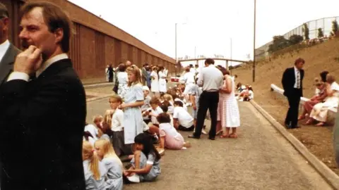
1970s-1990s: Completing the inner ring road
Although the Telford Way bridge was a step forward, its eastern end left drivers in Monkmoor and facing a journey towards the town centre to get anywhere else.
In 1971, Shropshire County Council produced a report recommending new roads from the Column area to Meole Brace (Pritchard Way and Hazeldine Way), to Telford Way (Bage Way) and to English Bridge (Old Potts Way).
 Trotman family
Despite a suggestion they could be completed by 1976, it took decades - Old Potts Way was not completed until the 1990s. But the finished roads, linked with the Telford Way bridge, gave an alternative north-south route around town.
 Shropshire Council
1992: The modern bypass
Probably the biggest step forward for drivers wanting to avoid Shrewsbury town centre was the completion of the A5 (and A49) bypass in 1992 around the east and south of the town.
Although Shrewsbury has grown to meet the "new" A5, especially in the south and west, it still very much marks the outer boundary of the town and is mostly dual carriageway. It also made another double crossing of the River Severn on the A49 stretch between Monkmoor and Uffington.
But although the question of a north-west section was under discussion by this point, it was to remain a talking point for decades more.
 Google
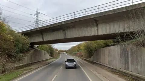
1999: Old century, (another) new bypass
Although the A49 bypass again helped traffic get from north to south, those who wanted to get from one side of the town to the other at the northern end had to cross through Harlescott, including a railway level crossing and increasingly busy crossroads.
The last major section of 20th Century bypass around Shrewsbury alleviated this by taking traffic from the A49/A53 junction across the northern side of town to Ellesmere Road. It opened in August 1999.
This provided a natural northern end for any future North West Relief Road - indeed it had been part of the early plans for it.
But with that road now looking less likely, traffic between there and the west of town either heads through the centre, or takes alternative routes through the neighbouring villages.
Follow BBC Shropshire on BBC Sounds, Facebook, X and Instagram.