Mayor unveils proposal for expanded city boundary

 Google
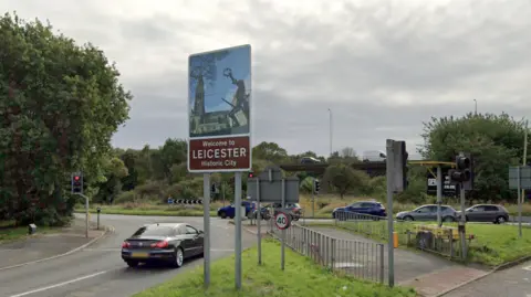
Leicester mayor Sir Peter Soulsby has unveiled proposals to expand the city's political boundaries.
The Labour politician has proposed a new political map that would see the city's present boundaries move outwards into suburban areas currently part of neighbouring councils.
The proposal will be lodged with the government, which plans to streamline local government and have a mayor for every region of England.
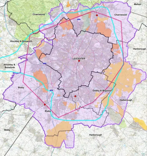
Under the plan, revealed on Wednesday, Leicester's current population of 372,000 would increase to 623,000 by 2028, the city council said.
Parts of Charnwood Borough Council, Harborough District Council, Oadby and Wigston Borough Council and Blaby District Council would merge with the city to form a new unitary authority
The city council said the expansion would be needed to provide land for "future housing growth".
 Leicester City Council
Soulsby said Leicester was one of the most tightly constrained major cities in the UK.
He added: "Critically, our almost uniquely constrained boundary means that now – unlike comparable cities – we have no chance of delivering the extra housing that our city so desperately needs within existing confines.
"The county and district councils all know that the existing city boundary makes no sense and has to change."
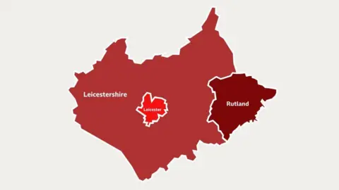
The city council has proposed the rest of Leicestershire and Rutland should fall under a single council serving a population of 578,000.
Leicestershire County Council has already outlined proposals to create one unitary authority for the whole county - replacing itself and the districts and boroughs - sitting around the city's current boundaries.
 Leicestershire districts & Rutland County Council
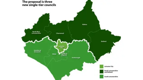
The districts' favoured model is for three unitary councils across Leicester, Leicestershire and Rutland.
A North Leicestershire and Rutland council would serve the area currently covered by Charnwood borough, North West Leicestershire district, Melton borough and Rutland County Council.
A separate South Leicestershire council would cover the areas of Blaby district, Harborough district, Hinckley and Bosworth borough and Oadby and Wigston borough councils.
Leicester city would remain unchanged.
Both proposals are now open for public consultation on the respective council websites.
Authorities are proposing more public engagement in the summer, as final proposals for local government reform must be submitted by 28 November 2025.
Follow BBC Leicester on Facebook, on X, or on Instagram. Send your story ideas to [email protected] or via WhatsApp on 0808 100 2210.