How London's East End has changed since EastEnders began

 BBC
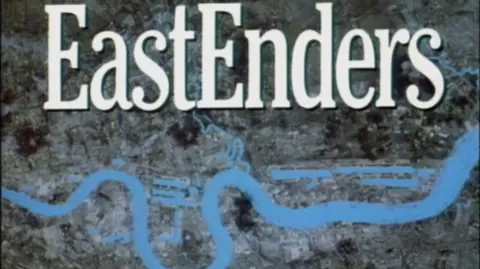
BBCFrom the first episode of EastEnders on 19 February 1985, we saw the now-familiar title sequence - the zoom out from the River Thames, revolving to show the East End, London docks and Isle of Dogs.
On that map there was no City Airport, no cluster of tall commercial buildings in the City of London, and no sign of the Canary Wharf skyscrapers.
The urban geography of the East End has changed drastically in those 40 years - and with it, the people.
Migration, changes to industry and Margaret Thatcher's policies are some of the reasons the cockney heartland is no longer what it was. But does something of that East End identity remain?
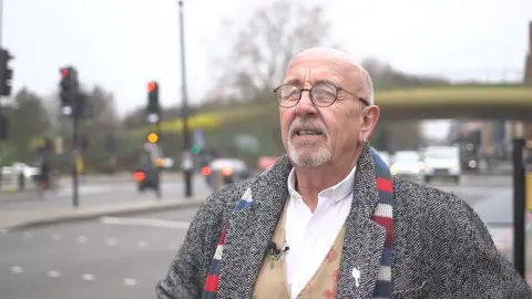
Chris Ross, who is known as the East End Poet, buys me a coffee and reminisces about growing up in Mile End: memories of the cinema they'd sneak into, the bomb sites that were their playgrounds, the people he used to know. But he doesn't romanticise the past.
"People say, 'Oh, I miss the old East End.' Yeah, what do you miss? The outside toilets or the old tin bath that you used to drag in, in front of the fire every Friday night and then take turns to get in? You know, is it that that you miss? No. No, it's not. You miss being young; we all miss that."
He says that Prime Minister Margaret Thatcher's 1980 Right to Buy scheme changed East End communities.
"In the 80s, when Mrs Thatcher sold everybody their council places - and then two years later they all sold them for a huge profit and went and moved out to the country - I think that had a huge impact to the East End to be perfectly honest.
"They all went to live in Clacton or the Costa del Sol or something, with their council house money," says Chris, laughing.
Though himself living a bit further east now, he says something of his old manor remains.
"I still walk down the Roman [Road] and see people I knew from way back when, or their kids or their kids and stuff. So there is something about it. There is something about that East End 'thing'."
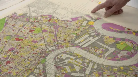
At the Cannon Workshops, in the shadow of Canary Wharf's towers, Reginald Beer shows me his collection of antique maps. The East End is there, on an 18th Century map - literally the eastern edge of the City of London. Islington is a genteel suburb some countryside away - and there isn't much at all south of the River Thames.
The 1951 map looks more familiar. Colour-coded, the yellow areas are derelict sites - mostly bomb damage from World War Two - covering large swathes of the East End, close to the docks.
It was during the 50s that the severe overcrowding and housing shortage were addressed. The notorious slum clearances began. People moved in large numbers to new council housing in places like the Isle of Dogs.
Reg says: "This is the time when tower blocks appeared. We lived in a house overlooking a canal. From there we moved into a prefab and we were given basically one choice because - 'it's coming down and you've gotta go' - and we moved into a tower block."
It wasn't a happy time for his mother, who missed her garden and easy access to neighbours.
As a local councillor for Tower Hamlets, Reg was involved in urban regeneration. "Our plan at the time, when I look back, basically created lots and lots of council housing but not many jobs to go with that development."
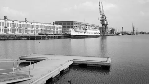 Mike Seaborne
London's docks used to be one of the largest employers in the east of the city. But the final boat was offloaded at the Royal Docks in 1981, ending a way of life that had been passed down through families for generations.
Ronald Webb is the last living union officer for the National Amalgamated Stevedores and Dockers, known as the "Blue Union". When he and some 22,000 others lost their jobs, he says the impact on the East End was profound.
"At that particular time, you've got to realise the East End was made up of family communities. So if you went in a certain street, you'd save your bet that about half that street was related to one another. And once the docks closed, they moved people out to other areas and it broke up that family circle that you had there."
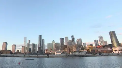
Big buildings and big money stand in place of ships and busy cranes now. Here, the gap between what workers and residents earn is the largest in the UK.
In a part of London defined by migration, every time a swathe of people moves out, others move in. If categorised by the borough, Tower Hamlets has the largest Bangladeshi and Muslim population in England and Wales, according to the 2021 Census.
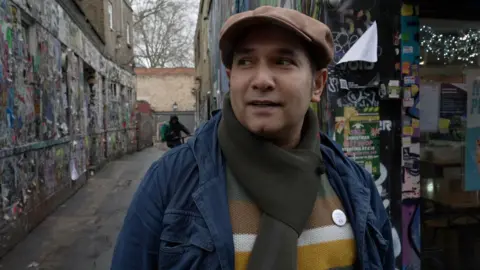
Saif Osmani, co-founder of the Modern Cockney Festival, himself of Sylheti-Bengali heritage, says that a lot of today's demographic stays true to the East End identity.
"If you walk down Brick Lane, Bethnal Green, Whitechapel you still see that the bedrock of the East Enders is there. It's a place where working communities come together, find opportunities, interact with their neighbours. I don't buy into this idea that the East End has actually broken up. It's still here. It's still living and breathing."
And there are still cockneys - the "non-posh Londoners" as he calls them - continually evolving with influence from incomers from around the world, as he says has been the case for centuries.
The bigger threat to today's East End working-class communities, Saif says, is the creep of commercial development.
"We are seeing huge changes and so as local people we have to sometimes fight it, we have to be able to negotiate our space within the city and sometimes that's very difficult. Campaigns like the 'Save Brick Lane' campaign, we've really tried to push for local issues."
Thus continuing another honoured tradition in the East End: political activism and the push for reform.
So the map on the EastEnders title sequence looks very different; the skyline of our city has changed and with it the population - but for now it seems, the East End ain't dead yet.